Situation Reporting System using Smartphone

In 2011, Thailand encountered its worst flooding in over decades, affecting over northern, northeastern, and central of Thailand along the Mekong and Chao Phraya river basins. The Federation of Thai Industries (FTI) estimated at least 95 billion Baht damage on Thai industry, 25 billion Baht damage to Thai agriculture, and 65 billion Baht damage to housing. The flood crisis impacted over 13 million people from 4 million families. During the flooding, many people asked for help through various channels to the emergency operation center, but it’s difficult to locate a clear position to deliver help. In addition, the information obtained from people is unclear, the officer cannot see the picture or the incident at that place, and lead to confusion in planning and difficult to understand the situation correctly. For reduce as above problem, if people can report the situation and sending the pictures or the position through the software on a smartphone to the emergency operation center, that will help the officer to understand the situation correctly, and plan to help people efficiently.
The smartphone is widely used in all shapes and factors of life. Current projections predict the total number of smartphones in Thailand is over 82 million or 122% relative to population in 2018. All smartphones can take photos, videos, and locate position using GPS technology, that means, people can use a smartphone to report situations from various points and send via 3G/4G network to the emergency operation center. The officer can see photos, videos, and position from people who request help on the map, that gives an overview of the situation to the officer, and lead to effective planning to help people.
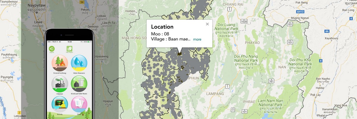
This concept applies to environmental reporting with the Department of Environmental Quality Promotion through ARSA4Thai (Android, iOS) application. The volunteer will use this program to report environmental issues such as wildfire, drought, smog, pollution, etc. All information will be displayed on the map in the war room, and the officer in charge will coordinate with the relevant agencies. This concept can be further developed to connect with other devices such as water level sensor, city camera, etc. or expand the system to support other situation reporting, and bring the information together, including creating a simulation system for rehearsing to handle the situation that may occur.
People can upload photos, videos, and location of situation to the officer in charge. The officers can see what is happening on the map, this helps to understand the situation correctly, and plan to help.

